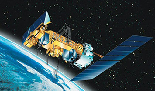

TIROS-N
The POES program began its journey in 1978, with the launch of the TIROS-N satellite. These satellites operated in a polar orbit, circling the Earth approximately 14 times a day and capturing detailed, high-resolution images of our planet. This orbital path ensured coverage of the entire globe, making POES a cornerstone of global weather and environmental monitoring.
Unlike geostationary satellites, which remain fixed over a single location, POES satellites traverse the Earth from pole to pole. This unique perspective allowed for close-up imaging of polar regions and comprehensive data collection—critical for accurate weather prediction, sea ice monitoring, and environmental analysis.
As we approach the end-of-life (EOL) phase for the NOAA Polar-orbiting Operational Environmental Satellites (POES), it’s worth taking a moment to celebrate the storied history and immense contributions of this pioneering satellite program. POES, an integral part of global weather forecasting and climate monitoring for decades, is gradually transitioning into a well-earned retirement, leaving a legacy of innovation and excellence.
1983: Tracking the Ozone Hole

One of POES’ earliest groundbreaking achievements was its role in identifying and tracking the ozone hole over Antarctica. Using advanced instrumentation like the Total Ozone Mapping Spectrometer (TOMS), POES satellites provided the scientific community with a clearer understanding of this pressing environmental issue, influencing global policy changes such as the Montreal Protocol.
2005: Hurricane Katrina
When Hurricane Katrina devastated the Gulf Coast in 2005, POES satellites delivered critical data that helped meteorologists track the storm’s development and trajectory. The accurate weather models informed by POES data undoubtedly saved countless lives and showcased the satellites’ value in disaster preparedness.

2010s: Advancing Climate Science

Throughout the 2010s, POES played a pivotal role in studying climate change. By monitoring sea surface temperatures, atmospheric conditions, and long-term environmental trends, these satellites have been instrumental in painting a clearer picture of our planet’s changing climate. This data underpins ongoing research and policy decisions aimed at combating global warming.
Transitioning to a New Generation
As the POES era winds down, NOAA has already begun shifting its focus to next-generation technologies. The Joint Polar Satellite System (JPSS), launched in 2017, represents a significant leap forward. Equipped with cutting-edge sensors and enhanced imaging capabilities, JPSS builds upon the legacy of POES while addressing modern scientific and operational needs.
The transition ensures continuity in critical Earth observations while integrating newer technologies to improve accuracy, efficiency, and the speed of data delivery. These advancements are crucial in an era where extreme weather events and climate challenges demand real-time, actionable information.

The NOAA POES program has been a testament to human ingenuity, demonstrating how technology can transform our understanding of the natural world. As we bid farewell to this trailblazing program, we also celebrate its contributions to science, safety, and environmental stewardship.
In the years ahead, the lessons and legacy of POES will remain a guiding star, inspiring the next generation of satellites to reach even greater heights.